VALLÉE DE L'AMBLÈVE 
The Amblève (French) or Amel (German) is a 93 km long river in eastern Belgium in the province of Liège. It is a right tributary of the river Ourthe. The Amblève flows through the towns of Amel, Stavelot, Trois-Ponts, Remouchamps, and Aywaille. At the village of Coo (near Trois-Ponts) is the Coo Waterfall, which at 15 meters tall is not the highest but one of the better known waterfalls in Belgium.
Nr. 3 ranked on the 20 Best Sights in the district LiÈge
- Telefoon +(0)4 384 35 44
- E-mail info@ourthe-ambleve.be
- Adress avenue de la Porallée, 4920 Aywaille
- Website http://www.ourthe-ambleve.be
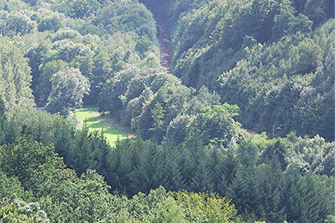
Landscape sight in Aywaille, Belgium
avenue de la Porallée
4920 Aywaille
· Sougné-Remouchamps
District: LiÈge
, Belgium
Route
to VALLÉE DE L'AMBLÈVE