Route
VALLÉE DE L'UBAYE
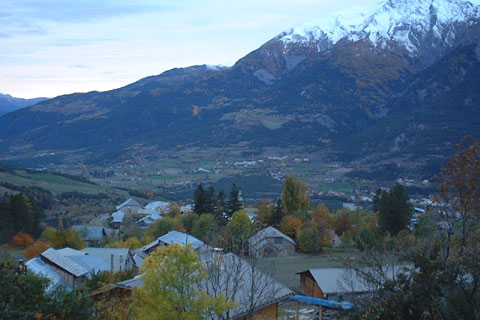
VALLÉE DE L'UBAYE 
The Ubaye River gives its name to the valley. The Ubaye rises on the Franco-Italian border, in Longet Lake, in the massive of Monte Viso. It runs from east to west during 70 km, after it flows in the Serre-Ponçon Lake. Its main tributary is the Ubayette River, which rise in the Lauzanier Lake.
Awards & Ranking
Ranking nr. 2 Best Sights in the district Barcelonnette
- Telefoon +(0)4 92 81 04 71
- E-mail info@barcelonnette.com
- Adress Route D900, 04400 Barcelonnette
- Website https://www.barcelonnette.com/
Opening
hours & location
Landscape sight in Barcelonnette, France
Route D900
04400 Barcelonnette
District: Barcelonnette
, France
Route
to VALLÉE DE L'UBAYE
Overnight in style
Looking for a hotel nearby?

Discover our selection